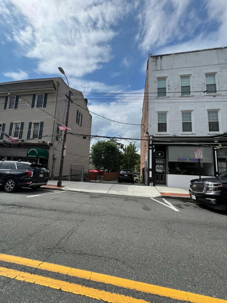
89 Main Street, Dobbs Ferry, NY 10522 Property Information
- General
- Owner
- Documents
- Tax
- Neighborhood
Address
| Primary address | 89 Main Street, Dobbs Ferry |
| Zip code | 10522 |
| County | Westchester |
| Municipality | Greenburgh |
| Parcel ID | 3.80-40-4 |
Sales & Tax Overview for 89 Main Street, Dobbs Ferry
View detailed information on past sales, title documents and property taxes, including the assessed market value, in their dedicated tabs.
| Sale date | 09/17/2015 |
| Sale price | $1,450,000 |
| Arm's length | Register |
| Current property tax | $4,189 |
Lot & Building Information for 89 Main Street, Dobbs Ferry
| Building class | Vacant Land Located in Commercial Areas (330) |
| Acreage | 0.07 |
Zoning, Use & Area Overview
| Zoning district | Register |
| School district | Dobbs Ferry |
View more neighborhood information such as transportation, nearby schools and risk designations in the dedicated tab.
Other Property Data for 89 Main Street, Dobbs Ferry
Property reports include comprehensive occupancy, improvement and development information (where available).
Create a free account to access valuable data points such as:
- • Improvements for 89 Main Street, Dobbs Ferry , including their type, square footage, grade and when they were built.
- • Development maps such as planimetric, zoning, land use and urban landscape maps (building age and stories).
Sign up
About 89 Main Street, Dobbs Ferry
The current market value is $178,000.
Ownership Information
View detailed property contacts like owners, building management, representatives from permits and tenants with a free account.
Spaces for Lease in 89 Main Street, Dobbs Ferry
| Listing type | For Lease |
|---|---|
| Listing date | 11/08/2024 |
| Last updated | 01/31/2025 |
| Lot size | 0.07 Acre |
Brokers
Past Sales & Property History for 89 Main Street, Dobbs Ferry
Create a free account to view the complete sales history for 89 Main Street, Dobbs Ferry, including title documents, transfer conditions, mortgages and liens.
| Purchase date | Purchase price | Buyer name | Seller name |
|---|---|---|---|
| 09/17/2015 | $1,450,000 | Register | Register |
Title Documents for 89 Main Street, Dobbs Ferry
To view the complete history of deeds, mortgages, assignments of leases and rents, and more, sign up for free. Available data goes back to 1966.
Sign up
R: Recorded date
D: Document date
Property Taxes for 89 Main Street, Dobbs Ferry
Access detailed property tax data for 89 Main Street, Dobbs Ferry, NY 10522. Tax information included: property tax, market value and assessed value, exemptions, abatements, and assessment history.
| Tax year | 2025 |
| Base tax | $5,220 |
| Current property tax | $4,189 |
| Market value | $178,000 |
| Assessed value | $178,000 |
Assessment History for 89 Main Street, Dobbs Ferry
Here's the assessment & property tax history for 89 Main Street, Dobbs Ferry, including the evolution of the total tax rate and corresponding property tax.
| Year | Market value | Assessment value | Total tax rate | Property tax | Year over year change |
|---|---|---|---|---|---|
| 2025 | $178,000 | $178,000 | 29.3239 | $5,220 | -3.35% |
| 2024 | $178,000 | $178,000 | 30.3405 | $5,401 | -1.44% |
| 2023 | $177,900 | $177,900 | 30.8016 | $5,480 | -4.03% |
| 2022 | $177,900 | $177,900 | 32.0959 | $5,710 | -3.55% |
| 2021 | $177,900 | $177,900 | 33.2761 | $5,920 | +4.38% |
Demographics by Zip Code
| Total population | 11,502 |
| Median age | 41.3 |
| Average household income | $204,218 |
| Family households | 71.3% |
| Occupied housing units | 3,962 |
| Owner occupied units | 63.9% |
| Average number of people per household | 2.69 |
| Median year structure built | 1955 |
| Median value for units with a mortgage | $807,500 |
| Median value for units without a mortgage | $683,000 |
Risk
Create a free account to unlock extended information for 89 Main Street, Dobbs Ferry, including whether it's located in FEMA flood zones, floodways or special flood hazard areas, as well as the Coastal barriers resources system area (COBRA).
| FEMA flood zone(s) | X (See more on map) |
Transportation
Access the detailed traffic volume map for 89 Main Street, Dobbs Ferry to see estimated average daily traffic on streets surrounding the property as well as the types of properties in its vicinity.
| View daily traffic map |
Neighbors for 89 Main Street, Dobbs Ferry
Here are the neighbors for 89 Main Street, Dobbs Ferry.
| Address | Square feet | Purchase date | Purchase price |
|---|---|---|---|
| 130 Palisade St, Dobbs Ferry | 1,551 | 01/13/2016 | $498,900 |
| 116 Palisade St, Dobbs Ferry | 1,320 | ||
| 91 Main St, Dobbs Ferry | 09/17/2015 | $1,450,000 | |
| 132 Palisade St, Dobbs Ferry | 1,056 | ||
| 118 Palisade St, Dobbs Ferry | 1,312 | 07/20/1999 | $41,900 |
| 134 Palisade St, Dobbs Ferry | |||
| 142 Palisade St, Dobbs Ferry | 1,344 | 05/28/2010 | $298,000 |
| 144 Palisade St, Dobbs Ferry | 1,280 | 07/10/2024 | $685,000 |
| 164 Palisade St, Dobbs Ferry | 2,020 | 10/14/2020 | $697,000 |
| 126 Palisade St, Dobbs Ferry | 1,680 | 02/26/2024 | |
| 98 Palisade St, Dobbs Ferry | 2,425 | 11/03/2020 | |
| 154 Palisade St, Dobbs Ferry | 2,356 | 02/16/2023 | $1,165,000 |
| 104 Palisade St, Dobbs Ferry | 2,406 | 08/03/2023 | $700,000 |
| 110 Palisade St, Dobbs Ferry | 1,100 | 07/14/2025 | $525,000 |
| 136 Palisade St, Dobbs Ferry | |||
| 148-150 Palisade St, Dobbs Ferry | 2,052 | ||
| 83 Cedar St, Dobbs Ferry | 1,330 | 01/29/2010 | |
| 114 Palisade St, Dobbs Ferry | 1,736 | 07/28/2025 | $1,325,000 |
| 156 Palisade St, Dobbs Ferry | 1,943 | 08/19/2019 | $565,000 |
| 122 Palisade St, Dobbs Ferry | 06/01/2018 |