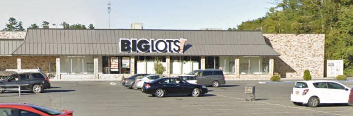
330 Route 212, Saugerties, NY 12477 Property Information
- General
- Owner
- Documents
- Tax
- Neighborhood
Address
| Primary address | 330 Route 212, Saugerties |
| Zip code | 12477 |
| County | Ulster |
| Municipality | Saugerties |
| Parcel ID | 17.16-2-28.100 |
Sales & Tax Overview for 330 Route 212, Saugerties
View detailed information on past sales, title documents and property taxes, including the assessed market value, in their dedicated tabs.
| Property tax | $89,032 |
Lot & Building Information for 330 Route 212, Saugerties
| Building sqft | 77,033 |
| Total sqft | 87,158 |
| Building class | Area of Neighborhood Shopping Centers (452) |
| Acreage | 7.4 |
| Lot dimensions | 330 ft X 200 ft |
| Buildings on lot | 2 |
| Frontage | 330 |
| Depth | 200 |
| Year built | 1970 |
| Stories | 1 |
| Water supply | Private |
| Sewer type | Private |
Zoning, Use & Area Overview
| Zoning district | Register |
| School district | Saugerties |
View more neighborhood information such as transportation, nearby schools and risk designations in the dedicated tab.
Other Property Data for 330 Route 212, Saugerties
Property reports include comprehensive occupancy, improvement and development information (where available).
Create a free account to access valuable data points such as:
- • Improvements for 330 Route 212, Saugerties , including their type, square footage, grade and when they were built.
- • Development maps such as planimetric, zoning, land use and urban landscape maps (building age and stories).
Sign up
About 330 Route 212, Saugerties
This Area of Neighborhood Shopping Centers (452) located at 330 Route 212, Saugerties, NY 12477 has a total of 77,033 square feet.
What is the year built & the current market value of 330 Route 212, Saugerties, NY 12477?330 Route 212, Saugerties, NY 12477 was built in 1970 and has a current tax assessor's market value of $5,059,000.
Ownership Information
View detailed property contacts like owners, building management, representatives from permits and tenants with a free account.
Spaces for Lease in 330 Route 212, Saugerties
| Listing type | For Lease |
|---|---|
| Listing date | 04/22/2025 |
| Last updated | 05/21/2026 |
| Lot size | 7.4 Acre |
Located at a lighted intersection between I-87 and the core market. This site is a gateway location for the Saugerties community.28,630 SF space is located off busy route 212 and has high visibility when entering the market from I-87. Strong co-tenancy including CVS, Starbucks, Subway, Family Dollar, and Advance Auto.
Brokers
| Suite name | Space type | Lease rate | Available space | Brokers |
|---|---|---|---|---|
| Anchor Space | Strip | $1/Sqft/Year | 28,630 | Benjamin Feinman |
Past Sales & Property History for 330 Route 212, Saugerties
Create a free account to view the complete sales history for 330 Route 212, Saugerties, including title documents, transfer conditions, mortgages and liens.
No recorded sales for this property.
Title Documents for 330 Route 212, Saugerties
Data not available for this property.
Property Taxes for 330 Route 212, Saugerties
Access detailed property tax data for 330 Route 212, Saugerties, NY 12477. Tax information included: property tax, market value and assessed value, exemptions, abatements, and assessment history.
| Tax year | 2025-2026 |
| Property tax | $89,032 |
| Market value | $5,059,000 |
| Assessed value | $5,059,000 |
Assessment History for 330 Route 212, Saugerties
Here's the assessment & property tax history for 330 Route 212, Saugerties, including the evolution of the total tax rate and corresponding property tax.
| Year | Market value | Assessment value | Total tax rate | Property tax | Year over year change |
|---|---|---|---|---|---|
| 2025 | $4,910,000 | $4,910,000 | 17.5987 | $86,410 | -15.35% |
| 2024 | $4,910,000 | $4,910,000 | 20.79 | $102,079 | -2.65% |
| 2023 | $4,383,500 | $4,383,500 | 23.92 | $104,853 | n/a |
Demographics by Zip Code
| Total population | 19,066 |
| Median age | 45.9 |
| Average household income | $111,868 |
| Family households | 55.0% |
| Occupied housing units | 8,524 |
| Owner occupied units | 69.2% |
| Average number of people per household | 2.21 |
| Median year structure built | 1962 |
| Median value for units with a mortgage | $348,300 |
| Median value for units without a mortgage | $301,800 |
Risk
Create a free account to unlock extended information for 330 Route 212, Saugerties, including whether it's located in FEMA flood zones, floodways or special flood hazard areas, as well as the Coastal barriers resources system area (COBRA).
| FEMA flood zone(s) | X (See more on map) |
Transportation
Access the detailed traffic volume map for 330 Route 212, Saugerties to see estimated average daily traffic on streets surrounding the property as well as the types of properties in its vicinity.
| View daily traffic map |
Neighbors for 330 Route 212, Saugerties
Here are the neighbors for 330 Route 212, Saugerties.
| Address | Square feet | Purchase date | Purchase price |
|---|---|---|---|
| 10 Delson Ln, Saugerties | 1,762 | 11/26/2024 | $193,000 |
| 154 Route 32a, Saugerties | 10/19/2022 | $70,000 | |
| 3944 Route 9W, Malden on Hudson | 1,862 | ||
| 187 Charles Smith Rd, Saugerties | 3,733 | ||
| 18 Browns Ln, Saugerties | 2,144 | ||
| 44-48 Kate Yaeger Rd, Saugerties | 2,634 | ||
| 1066 Main St, Malden on Hudson | 1,368 | 12/02/2022 | $225,000 |
| 241 Hommelville Rd, Saugerties | 1,188 | ||
| 148 Route 32a, Saugerties | 1,748 | ||
| 227 Hommelville Rd, Saugerties |