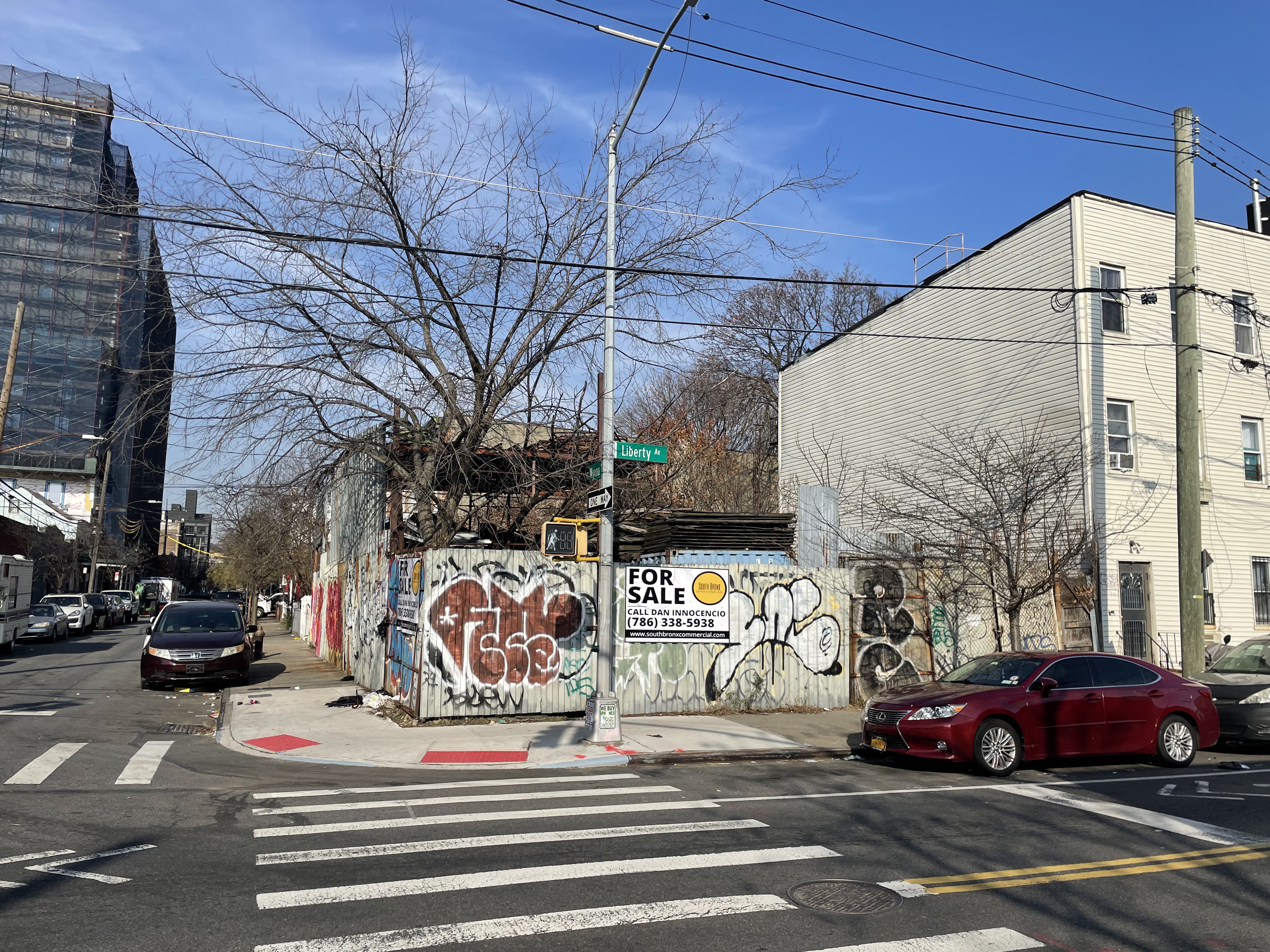
441 Liberty Avenue, Brooklyn, NY 11207 Property Information
- General
- Owner
- Documents
- Tax
- Permits
- Neighborhood
Address
| Primary address | 441 Liberty Avenue |
| Neighborhood | East New York |
| Zip code | 11207 |
| Borough | Brooklyn |
| Block & lot | 03690-0031 |
Sales & Tax Overview for 441 Liberty Avenue, Brooklyn
View detailed information on past sales, title documents and property taxes, including the assessed market value, in their dedicated tabs.
| Tax class | Register |
| Estimated property tax | $5,486 |
Lot & Building Information for 441 Liberty Avenue, Brooklyn
| Lot sq. ft. | 1,500 |
| Lot dimensions | |
| Property type | Unlicensed Parking Lot (G7)
|
| Frontage(s) | Liberty Avenue (wide) |
Zoning & Use for 441 Liberty Avenue, Brooklyn
| Zoning | Register |
Area Overview
| School district | 19 |
| Community district | 5 |
| Closest police station | 0.66 Miles |
| Closest fire station | 0.04 Miles |
View more neighborhood information such as transportation, nearby schools and risk designations in the dedicated tab.
Other Property Data for 441 Liberty Avenue, Brooklyn
New York property reports include comprehensive occupancy, development and violation information. Create a free account to access valuable data points such as:
About 441 Liberty Avenue, Brooklyn
Assessed at $55,800, the tax amount paid for 441 Liberty Avenue, Brooklyn, NY 11207 is $5,086. For the next year, the tax amount for 441 Liberty Avenue, Brooklyn, NY 11207 is estimated at $5,486.
When was 441 Liberty Avenue, Brooklyn, NY 11207 last sold?441 Liberty Avenue, Brooklyn, NY 11207 was last sold in 11/26/1991.
Ownership Information for 441 Liberty Avenue, Brooklyn
View property contacts like owners, building management, representatives from permits and tenants with a free account. For LLC-owned properties, access manually researched real owners and phone numbers.
Spaces for Sale in 441 Liberty Avenue, Brooklyn
| Listing type | For Sale |
|---|---|
| Listing date | 02/13/2024 |
| Last updated | 01/23/2025 |
| Lot size | 0.034 Acre |
- Sale Price: Call for price
- Size: 3,000 SF (40' X 150')
439 Liberty Avenue - 1,500 SF
441 Liberty Avenue - 1,500 SF
- Development:
- Residential: 9,000 BSF
- Commercial: 6,000 BSF
- Notes: Residential or commercial development permitted on corner parcel
Zoning: Industrial storage uses permitted on this site. Residential development is permitted as well.
FAR: You are permitted to build a 9,000 SF residential building or a 6,000 SF commercial building.
These prime properties, located near a subway and bus stop, offer great accessibility with easy access to Jackie Robinson Parkway and JFK Airport. Zoned for both residential and industrial use, it allows for a 9,000 SF residential or 6,000 SF commercial building, making it an ideal choice for diverse buyers.
Brokers
Past Sales & Property History for 441 Liberty Avenue, Brooklyn
Create a free account to view the complete sales history for 441 Liberty Avenue, Brooklyn, including title documents, transfer conditions, mortgages, liens, and pre-foreclosures.
No recorded sales for this property.
Title Documents for 441 Liberty Avenue, Brooklyn
To view the complete history of deeds, mortgages, assignments of leases and rents, and more, sign up for free. Available data goes back to 1966.
Sign up
R: Recorded date
D: Document date
Property Taxes for 441 Liberty Avenue, Brooklyn
Access detailed property tax data for 441 Liberty Avenue, Brooklyn, NY 11207. Tax information included: property tax, market value and assessed value, exemptions, abatements, and assessment history.
| Tax year: | 2025-2026 |
| Property tax: | $5,087 |
| Estimated property tax: | $5,486 |
| Tax assessor's market value: | $124,000 |
| Assessed value: | $55,800 |
Assessment History for 441 Liberty Avenue, Brooklyn
Here's the assessment & property tax history for 441 Liberty Avenue, Brooklyn, including the evolution of the total tax rate and corresponding property tax.
| Year | Market value | Assessed value | Taxable | Tax rate % | Base tax | Property tax | Year over year change |
|---|---|---|---|---|---|---|---|
| 2025/26 | $124,000 | $55,800 | $46,890 | 10.848% | $5,087 | $5,087 | +13.18% |
| 2024/25 | $118,000 | $53,100 | $41,760 | 10.762% | $4,494 | $4,494 | +13.06% |
| 2023/24 | $113,000 | $50,850 | $37,530 | 10.592% | $3,975 | $3,975 | +14.29% |
| 2022/23 | $89,000 | $40,050 | $32,670 | 10.646% | $3,478 | $3,478 | +14.79% |
| 2021/22 | $77,000 | $34,650 | $28,170 | 10.755% | $3,030 | $3,030 | +15.32% |
Permits for 441 Liberty Avenue, Brooklyn
The complete history of permits filed for 441 Liberty Avenue, Brooklyn, including new construction or demolition permits, plus any work pertaining to plumbing, heating and sprinkler systems is available with a free account. Available data goes back to 1990.
Sign up
East New York Residential Market Stats
Access a detailed real estate market overview of East New York so you can assess current trends, home values, types of properties sold and transaction volume.
View the median home sale price in East New York and compare it to other neighborhoods in Brooklyn.
Check out recently sold homes in Brooklyn and see how their prices compare.
Risk
| FEMA flood zone(s): | X (See more on map) |
Transportation
|
Distance to Subway
|
||||||||||||||||||||||||||||||||||||||||||||||||||||||||||||||||||||||||||||||||||||||||||||||||||
| Closest station | Pennsylvania Ave & Liberty Ave at NE Corner | |||||||||||||||||||||||||||||||||||||||||||||||||||||||||||||||||||||||||||||||||||||||||||||||||
| Station lines | A-C | |||||||||||||||||||||||||||||||||||||||||||||||||||||||||||||||||||||||||||||||||||||||||||||||||
| Distance (miles) | 0.153 | |||||||||||||||||||||||||||||||||||||||||||||||||||||||||||||||||||||||||||||||||||||||||||||||||
|
||||||||||||||||||||||||||||||||||||||||||||||||||||||||||||||||||||||||||||||||||||||||||||||||||
|
Bus Routes
|
||||||||||||||||||||||||||||||||||||||||||||||||||||||||||||||||||||||||||||||||||||||||||||||||||
| Name | Atlantic Av/Vermont St | |||||||||||||||||||||||||||||||||||||||||||||||||||||||||||||||||||||||||||||||||||||||||||||||||
| Line | Q24 | |||||||||||||||||||||||||||||||||||||||||||||||||||||||||||||||||||||||||||||||||||||||||||||||||
| Distance (miles) | 0.075 | |||||||||||||||||||||||||||||||||||||||||||||||||||||||||||||||||||||||||||||||||||||||||||||||||
Schools
Nearest elementary schools
| Name | Rating | Att. zoned | Type | Grade range | No of students | Distance to school (mi) |
|---|---|---|---|---|---|---|
| P.S. 149 Danny Kaye | 5 | Yes | Public | PK, K-5 | 479 | 0.38 |
| P.S. 149 Danny Kaye | 5 | Yes | Public | PK, K-5 | 479 | 0.38 |
| P.S. 290 Juan Morel Campos | 5 | No | Public | PK, K-5 | 354 | 0.30 |
| P.S. 290 Juan Morel Campos | 5 | No | Public | PK, K-5 | 354 | 0.30 |
| St. Michael School | NR | No | Private | PK, K-8 | 0 | 0.32 |
Nearest middle schools
| Name | Rating | Att. zoned | Type | Grade range | No of students | Distance to school (mi) |
|---|---|---|---|---|---|---|
| Liberty Avenue Middle School | 4 | Yes | Public | 6-8 | 439 | 0.53 |
| Vista Academy | 7 | Yes | Public | 6-8 | 418 | 0.53 |
| Jhs 292 Margaret S Douglas | 5 | No | Public | 6-8 | 351 | 0.24 |
| St. Michael School | NR | No | Private | PK, K-8 | 0 | 0.32 |
| Salve Regina Catholic Academy | NR | No | Private | PK, K-8 | 0 | 0.33 |
Nearest high schools
| Name | Rating | Att. zoned | Type | Grade range | No of students | Distance to school (mi) |
|---|---|---|---|---|---|---|
| W H Maxwell Career and Technical Education High School | 2 | No | Public | 9-12 | 408 | 0.16 |
| World Academy For Total Community Health | 2 | No | Public | 9-12 | 132 | 0.57 |
| High School For Civil Rights | 2 | No | Public | 9-12 | 140 | 0.57 |
| Performing Arts and Technology High School | 6 | No | Public | 9-12 | 319 | 0.57 |
| Captain Vernon a Richards High School-Fire | 3 | No | Public | 9-12 | 223 | 0.57 |
Data provided by GreatSchools.org © 2025. All rights reserved.
Neighbors for 441 Liberty Avenue, Brooklyn
Here are the neighbors for 441 Liberty Avenue, Brooklyn, NY 11207.
| Address | Square feet | Purchase date | Purchase price |
|---|---|---|---|
| 2744 Atlantic Ave, Brooklyn | 07/19/2019 | $1,275,000 | |
| 447 Liberty Ave, Brooklyn | 2,400 | 09/23/2025 | |
| 165 Bradford St, Brooklyn | 11,300 | ||
| 443 Liberty Ave, Brooklyn | 2,400 | 03/10/2017 | $633,000 |
| 453 Liberty Ave, Brooklyn | 02/28/2019 | $315,000 | |
| 168 Bradford St, Brooklyn | 1,360 | 09/12/2017 | $315,000 |
| 154 Bradford St, Brooklyn | 5,781 | 05/13/1999 | |
| 2748 Atlantic Ave, Brooklyn | 3,480 | 04/21/2023 | $1,300,000 |
| 2764 Atlantic Ave, Brooklyn | 6,090 | ||
| 161 Wyona St, Brooklyn | 1,992 | 08/31/2016 | |
| 155 Bradford St, Brooklyn | 1,200 | 08/27/2021 | $670,000 |
| 451 Liberty Ave, Brooklyn | 1,599 | 08/22/1979 | |
| 158 Bradford St, Brooklyn | 5,781 | 05/30/2002 | |
| 439 Liberty Ave, Brooklyn | 09/28/2005 | $25,000 | |
| 2762 Atlantic Ave, Brooklyn | 3,990 | 05/30/2008 | |
| 449 Liberty Ave, Brooklyn | 7,844 | 09/01/2023 | $3,800,000 |
| 2750 Atlantic Ave, Brooklyn | 2,900 | 02/18/1999 | |
| 445 Liberty Ave, Brooklyn | 2,400 | 07/01/2015 | $636,000 |
| 159 Wyona St, Brooklyn | 1,992 | 02/09/2006 | $424,000 |
| 162 Bradford St, Brooklyn | 5,781 | 07/07/1988 |