

California Real Estate | 3 minute read
Looking for Vacant Land in Los Angeles? Here’s a Map of All Vacant Lots in the County
BY Georgiana Mihaila | May 8, 2014
Wouldn’t it be great to be able to identify all Los Angeles vacant lots at a glance?
We thought that’s something you might be interested in, so we put together this useful map overlay that shows all tracts of vacant land spread around Los Angeles County, and included a breakdown by county-designated landuse – residential, commercial, industrial, agricultural – to make it even more helpful.

Designed to meet the needs of developers, investors and home builders alike, our handy Los Angeles Vacant Lots map is the ideal tool for spotting development and investment opportunities in record time.
Zoom in on your area of interest, then cruise the neighborhood for a visual representation of nearby vacant land tracts. To make it easier for you to identify the exact type of Los Angeles vacant land you’re interested in, we’ve included county landuse designations for each of them — simply use the map legend to guide your search.
Once you’ve identified a property that fits your criteria (location, landuse) click on the pin or zoom in to a parcel level and then select the particular parcel; a mini property report will pop up, providing you with valuable ownership data, zoning information, and a summary for that property. The mini report also features a Microsoft Bird’s Eye View link that allows you to zoom in on the property and get a better idea on the actual state of the vacant land.
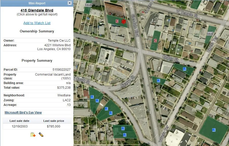
If you are interested in the property, click on the address on the upper side of the mini report and access the full property report, for detailed information. Once on the property report, you can quickly pull out comps for the vacant lot by using the ‘Find Comparables‘ tab in the upper left side of the property search bar.
For additional visual guidance, you can easily apply the overlay to one of our many basic maps and see if there have been any recent sales in the immediate vicinity of your targeted property (a good indicator of price and of general interest for the area), if the property falls under a FEMA Flood Zone, or what’s the current Tax Value per Square Foot for the property.
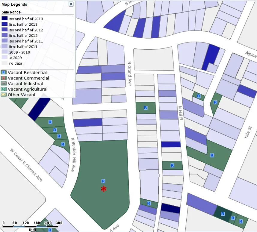
Recent Sales map with Vacant Lots overlay
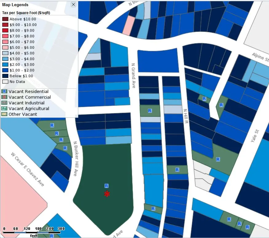
Tax Value per Square Foot with Vacant Lots overlay
Check out our entire collection of Los Angeles County maps — and feel free to use the comments section below to tell us what other maps you would find useful. We’re always happy to create new, interesting maps for our users.
Latest Posts
Want to stay on top of the real estate market?
Access comprehensive property data and ownership information with intuitive research tools.
POSTED IN: California Real Estate, Los Angeles Real Estate

After spending the first 6 years of her career training in the art of real estate alongside the Yardi team, Georgiana went on to become VP of Marketing for Montreal-based fintech company NestReady, then to run the marketing department behind one of the world’s leading self-dev media companies, Goalcast Inc. She’s now combining her passion for engaging content with a long-lasting addiction to real estate on FancyPantsHomes.com
Recent Reports

NYC Resale Gains & Losses: Every Borough Made Money in 2025, Except Manhattan
In 2025, NYC home-sellers mostly made money. But, in Manhattan, resales came with losses — and it was apartments and recent buyers that absorbed them.
World Cup or Your Mortgage/Rent? Ticket Prices Rival Host City Housing Costs
World Cup ticket prices rival monthly housing expenses in the 11 U.S. host cities, with even the cheapest seats covering weeks or even months of rent or mortgage payments.

Locked-In Owners, Mobile Renters: Homeowners Stay Put as Renters Move 3.7x More Across Largest U.S. Cities
Renters became the primary drivers of long-distance mobility across the largest U.S. cities, moving 3.7 times more than owners in 2024, as high mortgage rates and housing costs kept many homeowners in place.